Explanation:
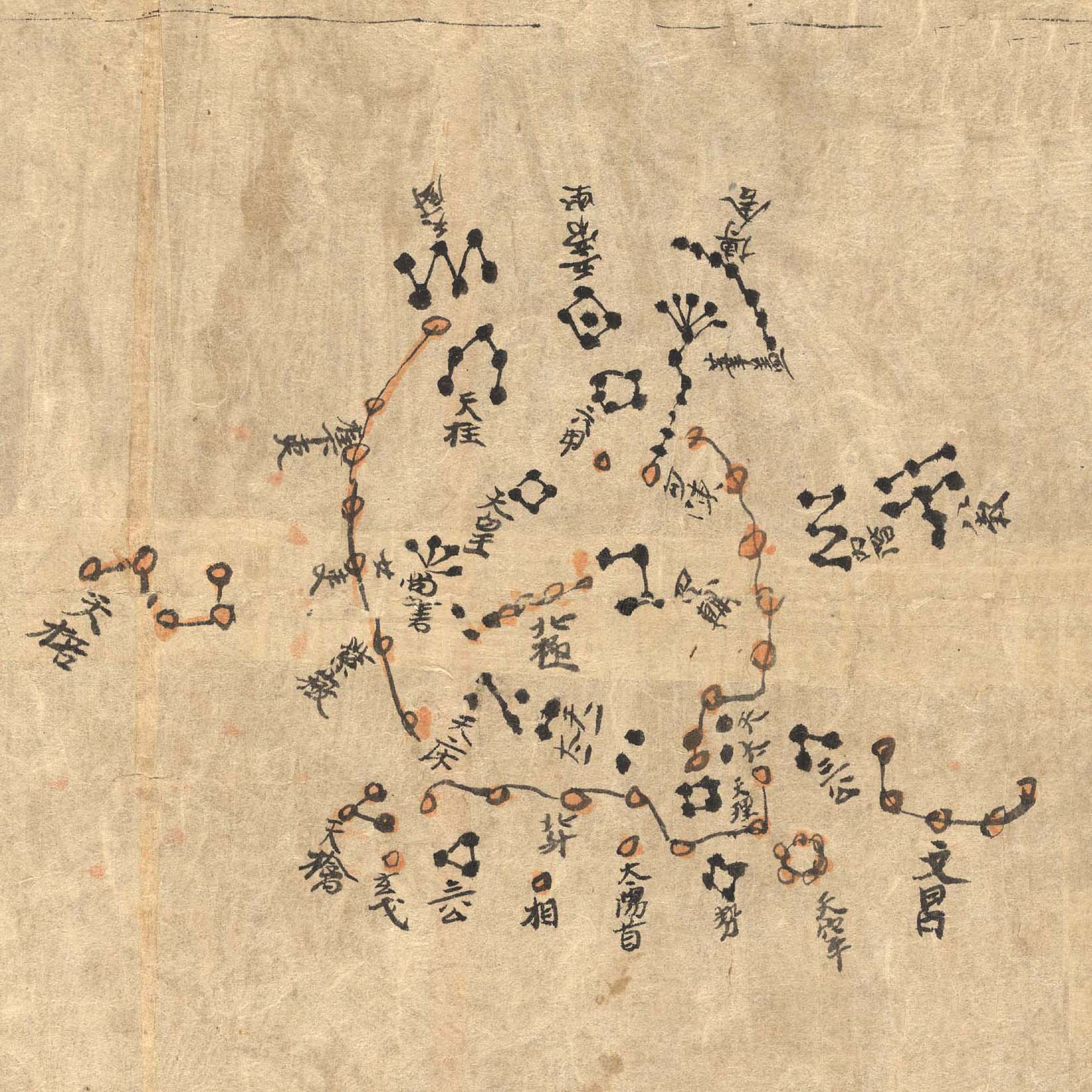
This ancient Chinese map of planet Earth's northern sky is part
of the Dunhuang Star Atlas, one of the most impressive
documents in the history of astronomy.
The oldest complete star atlas known, it dates to the years 649 to
684, discovered at the
Silk Road town of Dunhuang in 1907.
A recent analysis
that examines the accuracy and projections
used to make it notes the atlas marks positions of over
1,300 stars and outlines 257 Chinese
star groups or asterisms.
The star positions in the hand drawn atlas were found to be
accurate to within a few degrees.
In this example showing the north polar region, a very
recognizable Big Dipper, part of the modern
constellation Ursa Major, lies along the bottom of the chart.
An additional 12 charts depict equatorial regions in 30 degree
sections and also include a grouping resembling the modern
constellation Orion.
The atlas is on display
at the British Library in London to celebrate the
International Year of Astronomy.
digg_url = 'http://apod.nasa.gov/apod/ap090619.html'; digg_skin = 'compact';

