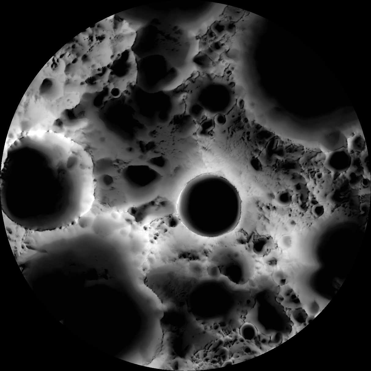
Explanation:
What is it?
It's a
multi-temporal illumination map, of course.
To make it, the wide angle camera on the Lunar Reconnaissance
Orbiter spacecraft collected 1,700 images
over a period of 6 lunar days (6 Earth months),
repeatedly covering an area centered on the
Moon's south pole.
Converted to
binary
values (shadowed pixels set to 0, illuminated pixels set to 1)
the images were stacked to
produce a map representing the percentage of time each
spot on the surface was illuminated by the Sun.
Remaining convincingly in shadow, the floor of the
19 kilometer diameter
Shackleton
crater is seen near the center of the map.
The lunar south pole itself is at about 9 o'clock on the crater's rim.
Since the Moon's axis of
rotation stays almost perpendicular
to
the ecliptic plane, crater floors near the lunar south
and north poles
can remain in permanent shadow and mountain tops in
nearly continuous sunlight.
Useful to future outposts, the shadowed crater floors could offer
reservoirs of water ice,
and the sunlit mountain tops ideal locations for solar power arrays.

